


route des volcans

adubarry
User
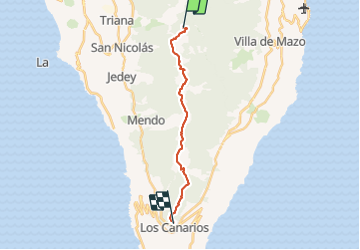

Length
17.6 km

Max alt
1927 m

Uphill gradient
679 m
Km-Effort
29 km

Min alt
729 m

Downhill gradient
1401 m
Boucle
No
Creation date :
2021-08-24 08:53:41.537
Updated on :
2021-08-24 16:44:25.545
6h39
Difficulty : Difficult

FREE GPS app for hiking
 SityTrail
IGN / Geographical institutes
SityTrail Plus
The world is yours!
About
Trail Walking of 17.6 km to be discovered at Canary Islands, Santa Cruz de Tenerife, El Paso. This trail is proposed by adubarry.
Positioning
Country:
Spain
Region :
Canary Islands
Department/Province :
Santa Cruz de Tenerife
Municipality :
El Paso
Location:
Unknown
Start:(Dec)
Start:(UTM)
222478 ; 3168491 (28R) N.
Comments